Interactive 10m×10m Pixel Paddock Explorer (UTM Zone 55S)
Hover over any 10m pixel across Merrigan's surveyed Graminus GIS paddocks to inspect live NDVI, NDMI moisture & Feed On Offer.
Hover over any paddock pixel for 10m telemetry...
1 Pixel = 10m × 10m (100 m²)
4-Panel Copernicus Sentinel-2C (10m) Multispectral Composite
1. True Colour Optical • 2. NDVI Vigour & FOO • 3. NDMI Canopy Moisture • 4. 7-Day Growth vs Grazing Differential
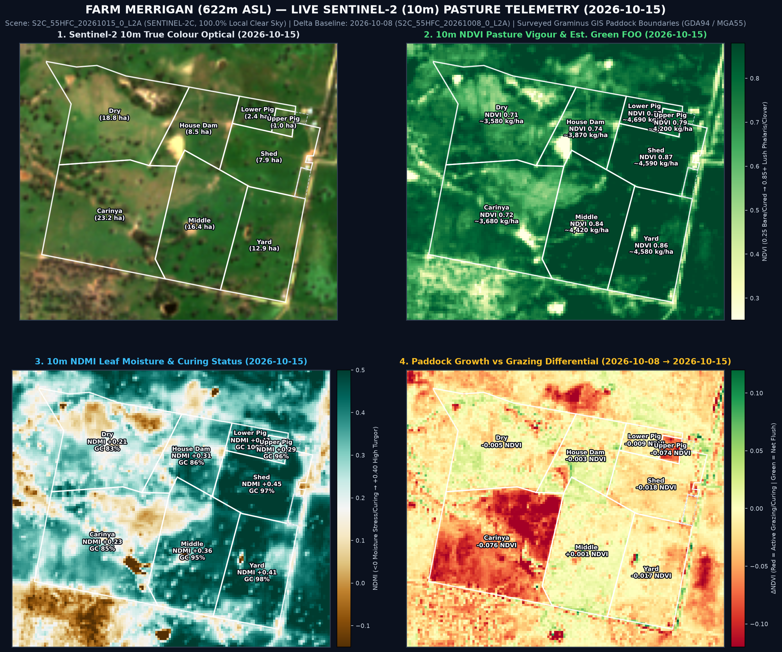
Surveyed Paddock-by-Paddock Sentinel-2 (10m) Pasture State & Multi-Pass Trajectory
Clipped to exact Graminus Consulting GIS polygons (EPSG:28355 GDA94 / MGA Zone 55) across 5 consecutive 100%-clear passes (25 Sep → 15 Oct 2026)
| Paddock | Area (ha) | 10m Pixels | 25 Sep NDVI | 30 Sep NDVI | 08 Oct NDVI | 15 Oct NDVI (P10–P90) | 7d ΔNDVI | NDMI Moisture | Green Cover | Est. FOO (kg DM/ha) | Total Standing DM | Graminus Agronomy Notes (Nathan Ferguson) |
|---|